For calculating LST from Landsat-7 ETM+ we would require thermal bands B6 from given satellite imageries. This tutorial will use collection 2 level 1 product with landsat product id “LE07_L1TP_142041_20030311_20200916_02_T1” of acquisition date 2003-03-11.
It is a two step process.
Step 1: Conversion of Digital Number (DN) to Top of Atmosphere(ToA) Spectral Radiance:
The Digital Numbers of Landsat 7 ETM+ should be converted to spectral radiance and is done using below formula.
Lλ= ((LMAXλ – LMINλ)/ (QCALMAX – QCALMIN) * (DN – QCALMIN)) + LMINλ
Where,
LMAXλ = Maximum spectral radiance for the B6 = 17.040
LMINλ = Minimum spectral radiance for the B6 = 0
QCALMAX = Maximum quantize calculated for the B6 = 255
QCALMIN = Manimum quantize calculated for the B6 = 1
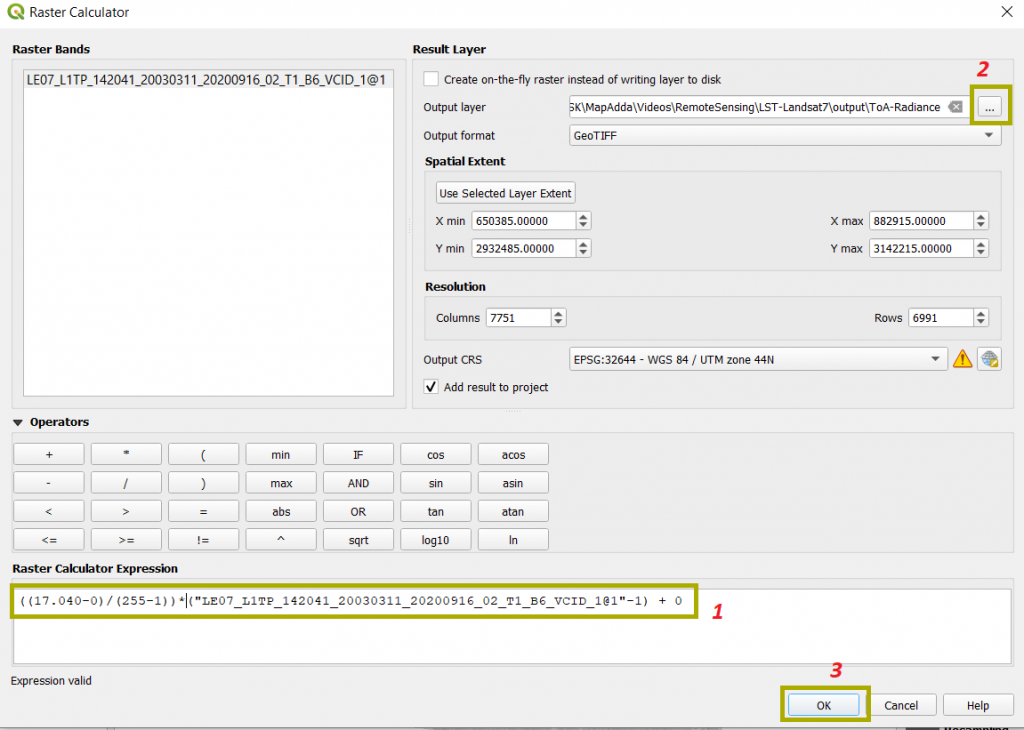
Simply copy the below code in raster calculator expression as shown below:
((17.040-0)/(255-1)) * (“Your B6 image”-1) + 0
Save it to a folder with filename ‘ToA-Radiance’ and click on ok.

If everything goes right you will see a filename ‘ToA-Radiance’ in your directory.
Step 2: Conversion of Spectral Radiance to Radiant Surface Temperature:
TC = (K2/ (ln((K1/ Lλ)+ 1)) – 273.15
Where,
Lλ = ToA spectral randiance obtained from step 1
TC = TOA brightness temperature in Celcius or simply LST
K2 = calibration constant 2 for B6 = 1282.71
K1 = calibration constant 1 for B6 = 666.09
NOTE: All above constants values can be obtained from mtl file of satellite image.
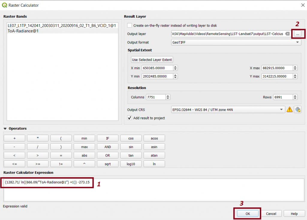
Again, go to raster calculator expression; copy & paste the below code
(1282.71/ ln((666.09/”ToA-Radiance@1″) +1)) -273.15
Save it to a folder with filename ‘LST-Celcius’ and click on ok.

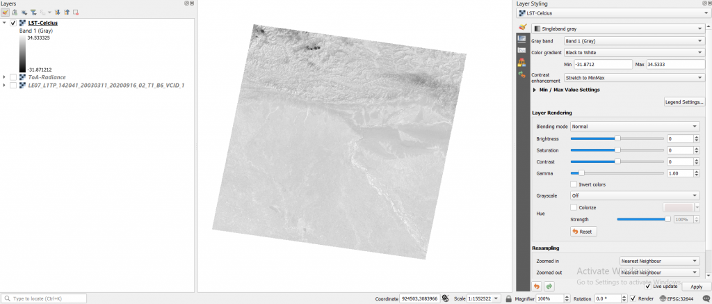
Finally, you will get Land Surface Temperature in degree celcius like below.

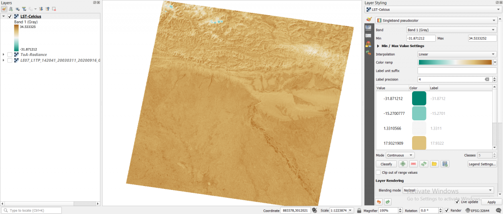
You can clip this raster with your desired area of interest shapefile and apply a bit of symbology as well.

Want to calculate LST from Landsat-8 ? Watch our video on youtube.
REFERENCES:
J. U., R., & Abah, I. A. (2019). Derivation of Land Surface Temperature (Lst) From Landsat 7 & 8 Imageries and Its Relationship With Two Vegetation Indices (Ndvi and Gndvi). International Journal of Research -GRANTHAALAYAH, 7(2), 108–120. https://doi.org/10.29121/granthaalayah.v7.i2.2019.1013
Ali, H. Z. (2021). Estimation of surface temperature using landsat satellite images and geographic information systems for environmental studies in iraq. Journal of Physics: Conference Series, 1895(1). https://doi.org/10.1088/1742-6596/1895/1/012006
Ghouri, A. Y., & Khan, A. (2022). Monitoring The Land Surface Temperature and Its Correlation with NDVI of Chiniot by Using GIS Technology and Remote Sensing. Earth & Environmental Science Research & Reviews, 5(2). https://doi.org/10.33140/eesrr.05.02.01

