Projection is the process of transformation of higher dimensional space (3D) into a lower dimensional space (2D). If we talk about measurement, Projected coordinate system is more accurate than Geographic coordinate system. It is one of the frequently done task in GIS.
In this tutorial, you will learn to project a vector data to any desired coordinate system. For this follow the given steps:
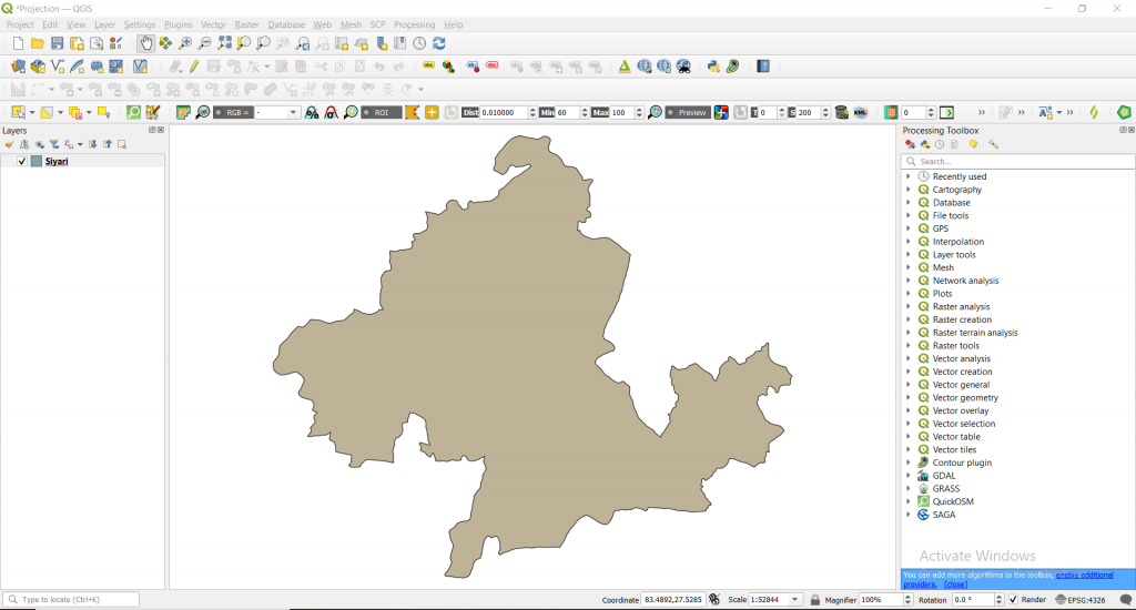
Step 1: Load the vector data ‘Siyari’ in Layers panel.
Step 2: Double left click ‘Siyari’ layer -> Information -> under Coordinate Reference System you will see Name: EPSG:4326 – WGS 84
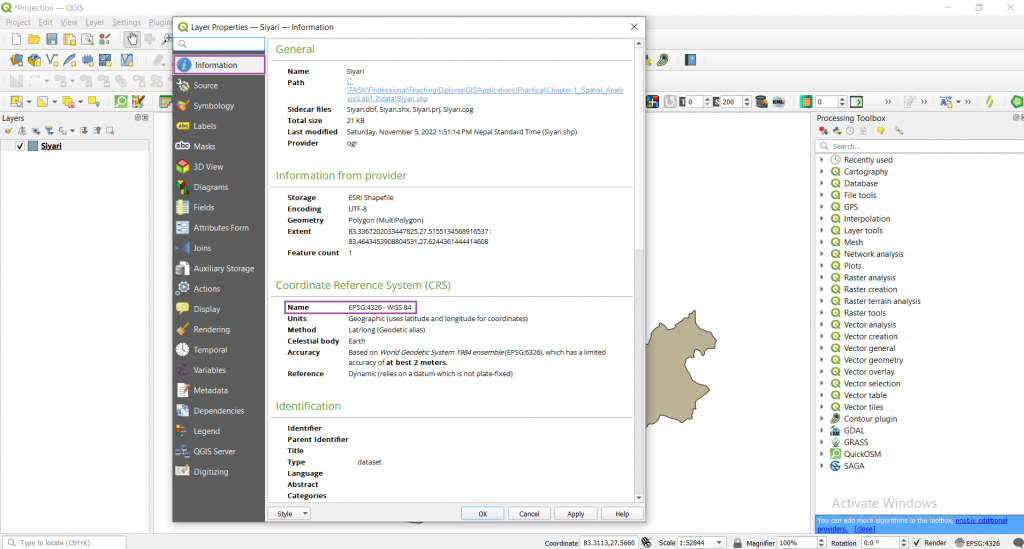
It means our data is in WGS 84 Geographic Coordinate System and we need to convert this to Projected Coordinate system (lets say 44N).
Converting data from Geographic Coordinate System to Projected Coordinate system
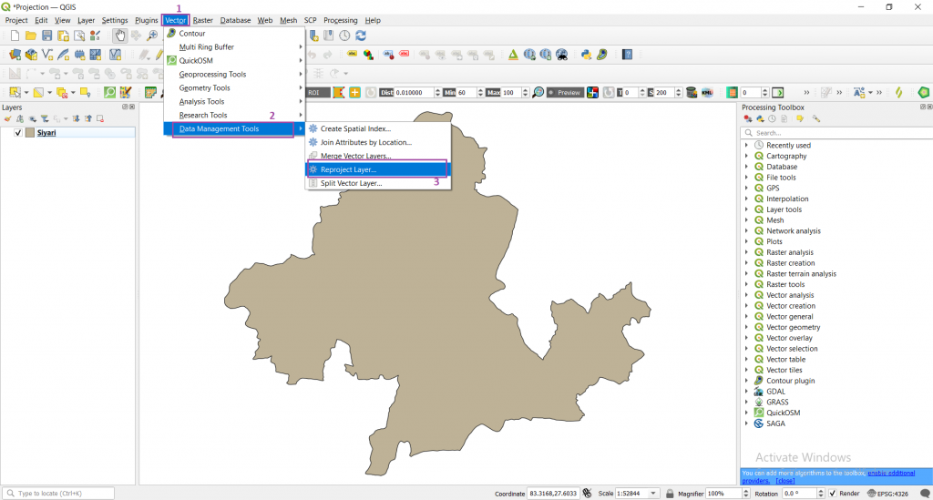
Step 3: Click on Vector -> Data Management Tools -> Reproject Layer
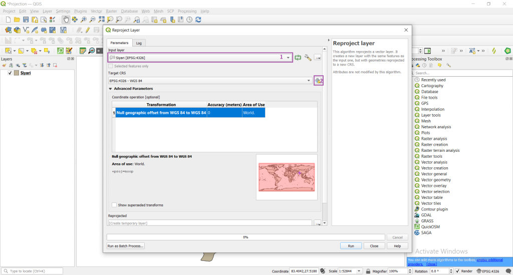
A new window will appear where you have to adjust the following settings.
Step 4: Keep Input layer as default -> click on earth icon in Target CRS
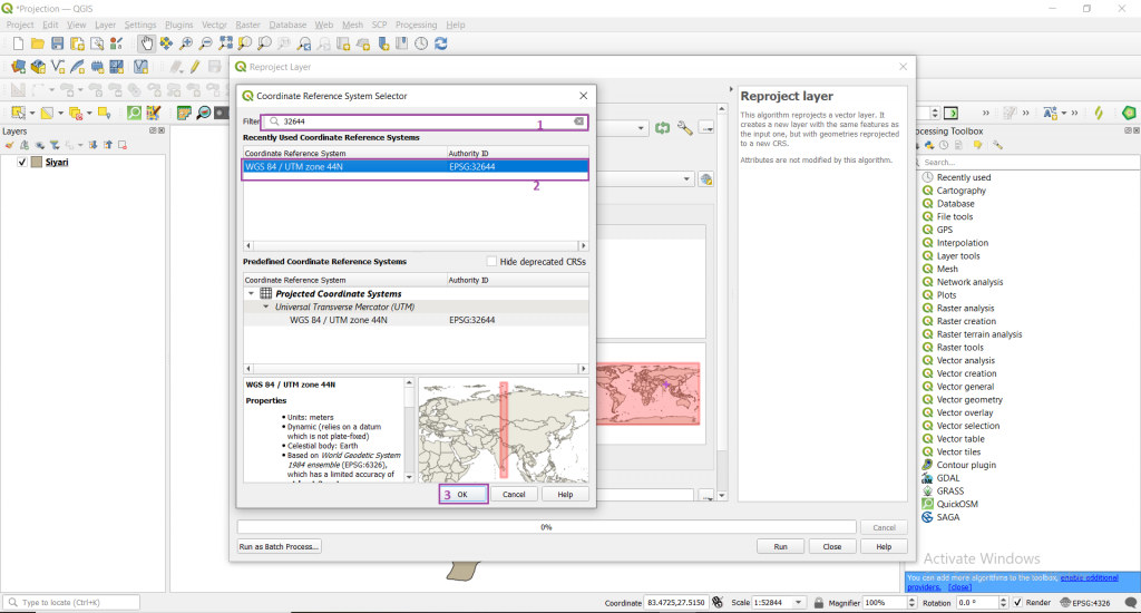
Step 5: Search for 32644 in Filter menu -> click on WGS 84/ UTM zone 44 N -> click ok
For 44N EPSG is 32644. Likewise for different coordinate systems there are different EPSG. For your desired coordinate system you can get EPSG value from here.
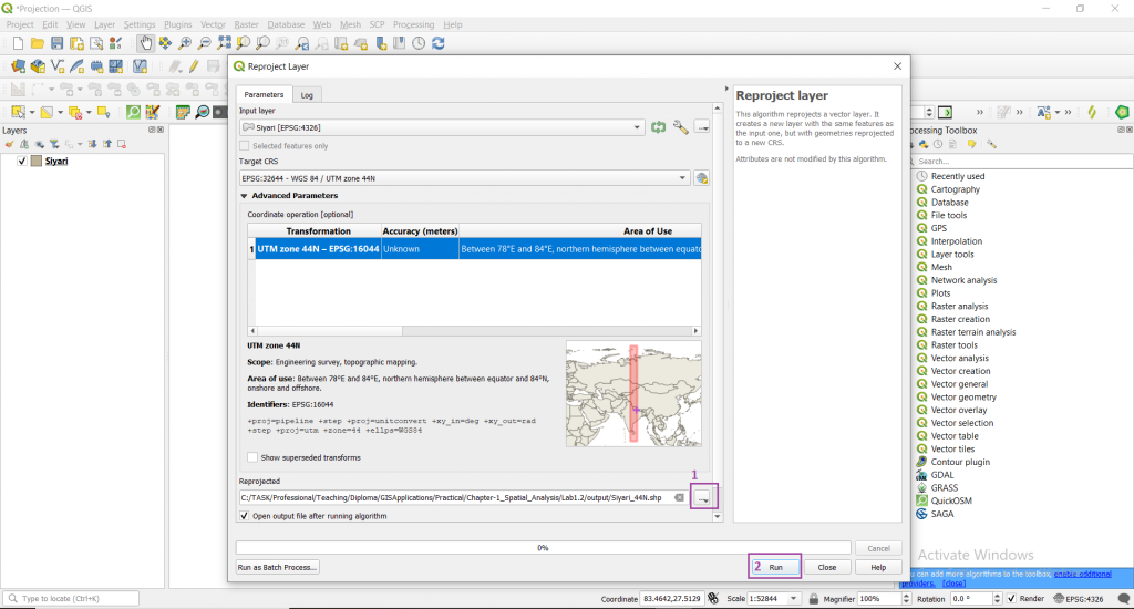
Now your Target CRS will be seen as WGS 84/ UTM zone 44 N
Step 6: Save it as ‘Siyari_44N’ to your desired location by clicking three dots icon in ‘Reprojected’ menu -> click Run
If everything goes fine you will get following output.
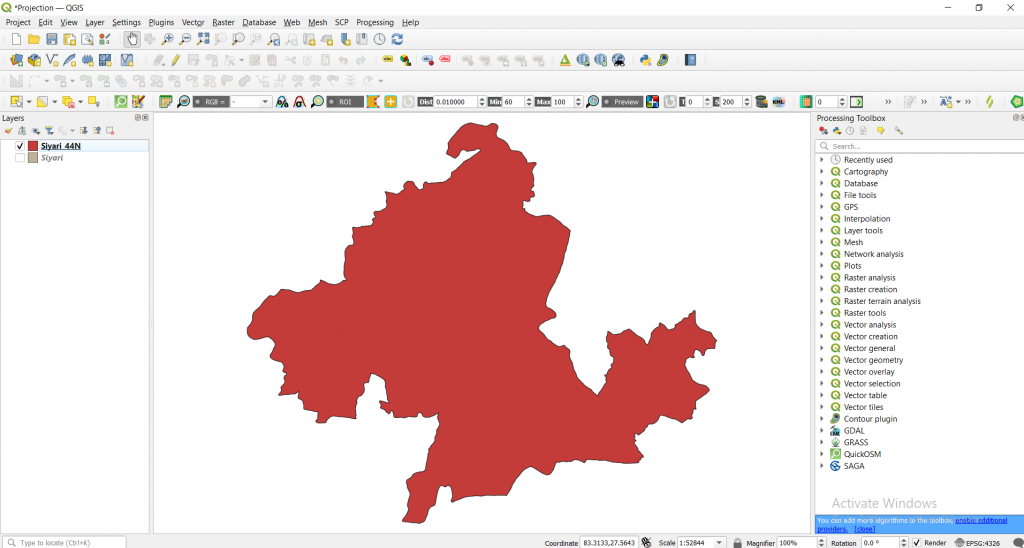
If you see its Coordinate Reference System. Now it has been changed to WGS 84/ UTM zone 44 N.
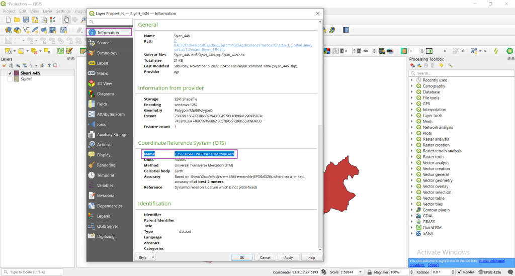
Finally, a new projected data has been obtained.


