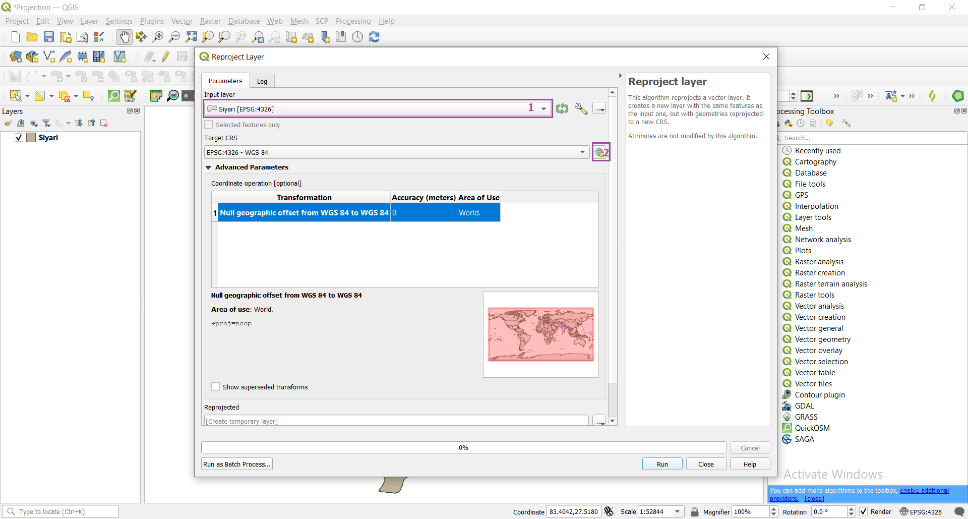
How to do projection of a vector data in QGIS ?
Projection is the process of transformation of higher dimensional space (3D) into a lower dimensional space (2D). If we talk about measurement, Projected coordinate system is more accurate than Geographic coordinate system. It is one of the frequently done task in GIS.